In the evolving landscapes of real estate and construction, staying ahead of the competition requires innovative approaches to visualize and market properties effectively. Aerial photography, particularly through the use of drones, is reshaping these industries by providing new perspectives that traditional photography simply can’t match. In this blog post, we will delve into the benefits of aerial photography for real estate and construction, demonstrating how Drone Perspective , based in Charlotte, NC, can elevate your projects to new heights.
The Revolution of Aerial Photography in Real Estate
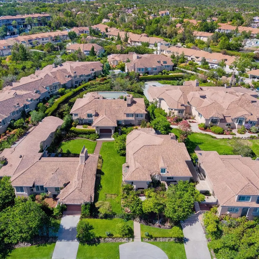
In real estate, the first impression is crucial. Aerial photography offers prospective buyers a grand view of properties, capturing not just the home but also its surroundings in one compelling image. This perspective helps highlight features such as landscaping, location, and proximity to amenities, which are often missed in ground-level photos. By showcasing properties in their entirety, aerial photography enhances visual storytelling, making listings more attractive and engaging.
Moreover, aerial imagery can provide a sense of scale, helping potential buyers appreciate the size and layout of a property relative to its environment. This is particularly beneficial in capturing large estates, commercial properties, and unique landscapes. Drone Perspective leverages cutting-edge drone technology to offer high-resolution, breathtaking visuals that enhance real estate listings, setting them apart in a competitive market like Charlotte.
Enhancing Construction Project Management
Aerial photography is not only transforming real estate marketing but also proving to be an invaluable tool in construction project management. By providing detailed overhead views and the ability to monitor progress from above, drones offer site managers and stakeholders a unique perspective on their projects. This capability allows for more efficient planning, tracking, and troubleshooting.
Drones equipped with high-resolution cameras can capture intricate details, facilitating accurate site assessments and inspections. This is particularly useful for identifying potential issues such as structural inefficiencies, site obstructions, or environmental impacts early in the construction process. In a bustling city like Charlotte, where construction projects are numerous and complex, having access to comprehensive aerial views can significantly enhance project oversight and efficiency.
Benefits Specific to the Charlotte Area
Charlotte, with its vibrant real estate market and rapidly growing construction industry, is an ideal location to leverage the benefits of aerial photography. Drone Perspective ’s operations are deeply rooted in the area, providing personalized service tailored to the unique needs and landscapes of the region. Local expertise ensures that projects not only comply with regulations but also capitalize on the most stunning aspects of Charlotte’s diverse environments.
Real estate agents in Charlotte can use aerial photography to attract more buyers by highlighting the city’s picturesque neighborhoods and proximity to local attractions. For construction firms, drones provide a competitive edge by enabling innovative project management techniques and comprehensive site analyses, essential for maintaining budgets and timelines.
Conclusion
As technology continues to advance, the use of drones in real estate and construction will only become more prevalent. Drone Perspective stands at the forefront of this innovation, offering clients in Charlotte and beyond a chance to take their vision to new heights. By embracing aerial photography, real estate professionals can enhance property marketing, while construction managers can revolutionize project execution. Whether it’s capturing stunning landscapes or providing critical oversight, the sky is no longer the limit—it’s the starting point.