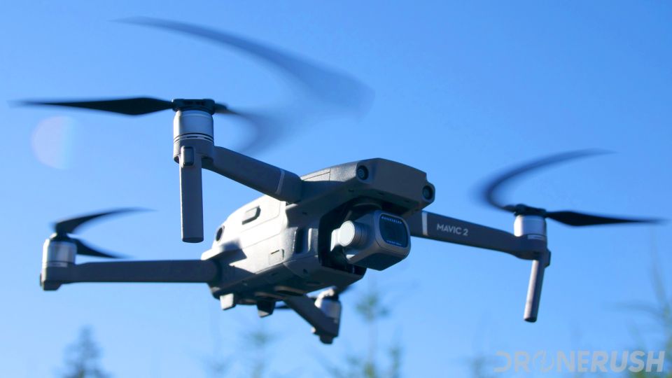
Exploring the Versatility of Drones North Carolina with Drone Perspective LLC
The rise of drone technology has revolutionized various industries across the globe, and North Carolina is no exception. At Drone Perspective LLC, we specialize in providing comprehensive drone services tailored to meet the diverse needs of our clients in this vibrant state. In this article, we’ll delve into the multifaceted applications and benefits of drones in North Carolina.
North Carolina's agricultural sector has greatly benefited from the integration of drones. Farmers use drones for crop monitoring, soil analysis, and precision agriculture. With the ability to capture high-resolution aerial images, drones provide valuable insights into crop health, irrigation needs, and pest infestations, enabling farmers to make informed decisions and optimize yields.
2. Construction
In the construction industry, drones play a crucial role in site surveys, progress monitoring, and inspections. Drones can quickly and accurately capture aerial views of construction sites, providing project managers with real-time data to track development, identify potential issues, and ensure projects stay on schedule and within budget.
3. Real Estate
The real estate market in North Carolina has embraced drone technology to enhance property listings and marketing efforts. Drones provide stunning aerial footage and 3D models of properties, offering potential buyers a unique perspective. This not only attracts more interest but also helps real estate agents showcase properties in the best possible light.
4. Emergency Services
Drones have become invaluable tools for emergency services in North Carolina. They are used for search and rescue missions, disaster assessment, and firefighting operations. Drones can quickly reach areas that are difficult for humans to access, providing crucial information and aiding in efficient and effective emergency response.
5. Environmental Monitoring
Environmental agencies in North Carolina use drones for monitoring wildlife, tracking environmental changes, and assessing the impact of human activities. Drones provide detailed data that helps researchers and conservationists make informed decisions to protect and preserve the state's natural resources.
Drones offer a cost-effective alternative to traditional methods of data collection and monitoring. They reduce the need for expensive equipment and labor-intensive processes, resulting in significant cost savings for businesses and organizations.
2. Time Savings
The speed at which drones can capture and process data is unparalleled. What once took days or weeks can now be accomplished in a matter of hours, allowing for quicker decision-making and more efficient project management.
3. Safety
Drones reduce the need for human involvement in hazardous situations, enhancing safety for workers and responders. Whether it's inspecting tall structures or assessing disaster-stricken areas, drones can perform tasks without putting lives at risk.
4. Precision and Accuracy
Equipped with advanced sensors and GPS technology, drones provide highly accurate and detailed data. This precision is essential for applications such as mapping, surveying, and monitoring, where even the smallest details matter.
The Expanding Role of Drones in North Carolina
Drones, also known as unmanned aerial vehicles (UAVs), have rapidly gained popularity in North Carolina due to their versatility and efficiency. From agriculture to construction, real estate, and emergency services, drones are transforming the way businesses and organizations operate.Key Applications of Drones in North Carolina
1. AgricultureNorth Carolina's agricultural sector has greatly benefited from the integration of drones. Farmers use drones for crop monitoring, soil analysis, and precision agriculture. With the ability to capture high-resolution aerial images, drones provide valuable insights into crop health, irrigation needs, and pest infestations, enabling farmers to make informed decisions and optimize yields.
2. Construction
In the construction industry, drones play a crucial role in site surveys, progress monitoring, and inspections. Drones can quickly and accurately capture aerial views of construction sites, providing project managers with real-time data to track development, identify potential issues, and ensure projects stay on schedule and within budget.
3. Real Estate
The real estate market in North Carolina has embraced drone technology to enhance property listings and marketing efforts. Drones provide stunning aerial footage and 3D models of properties, offering potential buyers a unique perspective. This not only attracts more interest but also helps real estate agents showcase properties in the best possible light.
4. Emergency Services
Drones have become invaluable tools for emergency services in North Carolina. They are used for search and rescue missions, disaster assessment, and firefighting operations. Drones can quickly reach areas that are difficult for humans to access, providing crucial information and aiding in efficient and effective emergency response.
5. Environmental Monitoring
Environmental agencies in North Carolina use drones for monitoring wildlife, tracking environmental changes, and assessing the impact of human activities. Drones provide detailed data that helps researchers and conservationists make informed decisions to protect and preserve the state's natural resources.
Benefits of Using Drones in North Carolina
1. Cost EfficiencyDrones offer a cost-effective alternative to traditional methods of data collection and monitoring. They reduce the need for expensive equipment and labor-intensive processes, resulting in significant cost savings for businesses and organizations.
2. Time Savings
The speed at which drones can capture and process data is unparalleled. What once took days or weeks can now be accomplished in a matter of hours, allowing for quicker decision-making and more efficient project management.
3. Safety
Drones reduce the need for human involvement in hazardous situations, enhancing safety for workers and responders. Whether it's inspecting tall structures or assessing disaster-stricken areas, drones can perform tasks without putting lives at risk.
4. Precision and Accuracy
Equipped with advanced sensors and GPS technology, drones provide highly accurate and detailed data. This precision is essential for applications such as mapping, surveying, and monitoring, where even the smallest details matter.
