Aerial Charlotte: Transforming the Sky with Drone Perspective LLC
The world of aerial imagery has seen a revolution over the past decade, driven by advancements in drone technology. This transformation is especially evident in **Aerial Charlotte**, where Drone Perspective LLC is at the forefront of providing cutting-edge aerial solutions. From enhancing real estate marketing to supporting construction projects and improving public safety, drones are reshaping how we capture and utilize aerial data. In this comprehensive article, we will explore how Drone Perspective LLC is leading the evolution of **Aerial Charlotte** and why drone technology is vital for various industries in the city.
## The Rise of Aerial Imagery in Charlotte
The concept of aerial imagery is not new, but its accessibility and utility have dramatically increased with the introduction of drones. Historically, aerial photos were taken from helicopters or small planes, making the process expensive and less accessible. Today, drones offer a cost-effective, efficient, and safer alternative, making high-quality aerial imagery available to a broader audience.
### Drone Photography and Videography
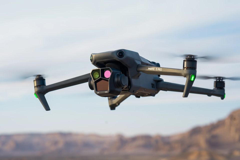
One of the primary applications of drones is in photography and videography. In **Aerial Charlotte**, Drone Perspective LLC uses state-of-the-art drones equipped with high-resolution cameras to capture stunning aerial photos and videos. These visuals are not only beautiful but also provide invaluable data for various industries.
**Aerial Charlotte** drone photography is widely used in real estate to showcase properties from unique angles, highlighting features that are not visible from the ground. This approach helps real estate agents and property developers market their listings more effectively, attracting potential buyers with captivating visuals.
In addition to real estate, drone videography creates compelling content for events, tourism, and marketing campaigns. **Aerial Charlotte** videos capture the beauty of the city's skyline, parks, and landmarks, providing engaging content that can be used across multiple platforms.
### Mapping and Surveying
Drones have also revolutionized mapping and surveying, providing accurate and detailed data that is crucial for construction, land development, and environmental monitoring. Drone Perspective LLC's **Aerial Charlotte** mapping services utilize drones to create high-resolution maps and 3D models of land areas, offering a level of detail that is difficult to achieve with traditional methods.
This technology is especially beneficial for construction companies, allowing them to survey sites quickly and efficiently. Accurate 3D models help in planning and design, ensuring that projects are executed with precision. For environmental monitoring, drones can capture data on vegetation, water bodies, and wildlife habitats, supporting conservation efforts and land management.
### Inspections and Maintenance
**Aerial Charlotte** is also transforming the way inspections and maintenance are conducted. Drones are used to inspect hard-to-reach areas such as roofs, towers, and bridges without putting inspectors at risk. Drone Perspective LLC's inspection services provide high-resolution imagery and thermal imaging, identifying potential issues that may not be visible to the naked eye.
For infrastructure maintenance, drones offer a fast and efficient way to monitor the condition of assets. Regular aerial inspections help detect problems early, allowing for timely repairs and reducing the risk of major failures. This proactive approach is particularly important for utilities and transportation sectors, where maintenance is crucial for safety and reliability.
## Enhancing Public Safety with **Aerial Charlotte**
Public safety agencies in Charlotte are increasingly relying on drone technology to support their operations. Drones provide a versatile tool for emergency response, search and rescue, and law enforcement, enhancing situational awareness and improving outcomes.
### Emergency Response
During emergencies, time is of the essence. **Aerial Charlotte** drones can be deployed quickly to assess situations and provide real-time data to first responders. For example, in the event of a natural disaster, drones can survey affected areas, identifying damaged infrastructure and locating people in need of assistance.
Drone Perspective LLC collaborates with emergency services to offer rapid aerial assessments, supporting disaster response and recovery efforts. By providing real-time imagery and data, drones help responders make informed decisions, prioritize resources, and improve coordination.
### Search and Rescue
Drones are also invaluable for search and rescue missions. Equipped with thermal cameras, drones can detect heat signatures, locating missing persons in challenging terrain or adverse weather conditions. **Aerial Charlotte** search and rescue operations benefit from the aerial perspective, covering large areas quickly and increasing the chances of a successful rescue.
Drone Perspective LLC works with search and rescue teams to provide drone support for missions, enhancing their capabilities and enabling faster, more efficient operations. The use of drones in search and rescue not only saves time but also increases the safety of rescuers.
### Law Enforcement
Law enforcement agencies are leveraging **Aerial Charlotte** drones for various applications, including surveillance, crime scene investigation, and traffic monitoring. Drones offer a discreet and non-intrusive way to monitor events, gather evidence, and assess situations from a safe distance.
Drone Perspective LLC partners with law enforcement to provide drone services that enhance their operations. From capturing aerial footage of crime scenes to monitoring large gatherings, drones offer a valuable tool for maintaining public safety and security.
## **Aerial Charlotte** in Real Estate
The real estate industry has been one of the biggest beneficiaries of drone technology, with **Aerial Charlotte** services playing a crucial role in property marketing and development. Drone Perspective LLC offers a range of aerial services tailored for real estate professionals, helping them showcase properties in the best possible light.
### Property Listings
High-quality aerial photos and videos have become essential for effective property listings. **Aerial Charlotte** drone photography captures properties from unique angles, highlighting their features and surroundings. This approach provides potential buyers with a comprehensive view of the property, making listings more attractive and engaging.
Drone Perspective LLC's aerial imagery helps real estate agents and property developers create stunning marketing materials that stand out in a competitive market. Through captivating visuals, they can attract more potential buyers and accelerate the sales process.
### Development Projects
For developers, **Aerial Charlotte** drones offer valuable insights throughout the development process. From initial site surveys to monitoring construction progress, drones provide accurate and up-to-date data that supports decision-making and project management.
Drone Perspective LLC's construction monitoring services include regular aerial inspections, capturing images and videos that document the project's progress. These visuals help developers track milestones, identify potential issues, and ensure that construction is on schedule and within budget.
### Landscaping and Design
Aerial imagery is also beneficial for landscaping and design, providing a bird's-eye view that helps visualize layouts and plan outdoor spaces. **Aerial Charlotte** drone services can create detailed maps and models, supporting landscape architects and designers in their work.
Drone Perspective LLC collaborates with landscaping professionals to offer aerial surveys and mapping, providing the data needed to design functional and aesthetically pleasing outdoor spaces. These insights ensure that landscaping projects enhance the overall appeal and value of properties.
## Supporting Construction and Infrastructure Projects
The construction and infrastructure sectors have embraced drone technology for its ability to enhance efficiency, accuracy, and safety. **Aerial Charlotte** services by Drone Perspective LLC are transforming how construction sites are managed and how infrastructure is maintained.
### Site Surveys and Planning
Accurate site surveys are critical for successful construction projects. Traditional surveying methods can be time-consuming and labor-intensive, but drones offer a faster and more precise alternative. **Aerial Charlotte** drones can capture high-resolution images and create detailed 3D models of construction sites, providing the data needed for planning and design.
Drone Perspective LLC's surveying services help construction companies gather accurate site data quickly, allowing for informed decision-making and efficient project planning. By providing detailed aerial imagery and models, drones support the successful execution of construction projects.
### Progress Monitoring
Regular monitoring of construction progress is essential for ensuring that projects stay on track. Drones provide a convenient way to capture images and videos of the site, documenting progress and identifying any potential issues. **Aerial Charlotte** drone monitoring services help project managers keep a close eye on construction activities, ensuring that everything is proceeding as planned.
Drone Perspective LLC offers comprehensive construction monitoring, with regular drone flights capturing up-to-date visuals of the site. These images and videos provide valuable insights into the project's status, helping managers make timely adjustments and keep stakeholders informed.
### Inspection and Maintenance
Infrastructure maintenance is crucial for public safety and reliability. Drones are increasingly being used for inspecting infrastructure such as bridges, roads, and utilities. **Aerial Charlotte** inspection services provide high-resolution imagery and thermal data, identifying issues that may require maintenance or repair.
Drone Perspective LLC's inspection services support infrastructure maintenance by offering detailed assessments without the need for manual inspections. This approach is safer, faster, and more cost-effective, ensuring that infrastructure remains in good condition and serves the community effectively.
## Environmental Monitoring and Conservation
Drones are playing a growing role in environmental monitoring and conservation efforts. In **Aerial Charlotte**, Drone Perspective LLC is leveraging drone technology to support initiatives aimed at preserving natural resources and protecting wildlife.
### Vegetation and Land Use Mapping
Understanding vegetation patterns and land use is important for environmental management and conservation. Drones equipped with multispectral sensors can capture data on vegetation health, land cover, and land use changes. **Aerial Charlotte** services include detailed mapping and analysis, providing insights that support environmental planning and management.
Drone Perspective LLC's environmental monitoring services help organizations gather accurate data on vegetation and land use, supporting efforts to preserve natural habitats and manage land resources sustainably.
### Water Quality Monitoring
Water quality is a critical aspect of environmental health. Drones can be used to monitor water bodies, capturing imagery and data on water quality and pollution sources. **Aerial Charlotte** water quality monitoring services provide a non-intrusive way to assess and track changes in water bodies.
Drone Perspective LLC's water quality monitoring services support efforts to protect water resources in Charlotte, providing accurate data that informs conservation strategies and regulatory compliance.
### Wildlife Monitoring
Monitoring wildlife populations and behaviors is essential for conservation efforts. Drones offer a safe and efficient way to observe wildlife without disturbing their natural habitats. **Aerial Charlotte** drone services include wildlife monitoring, capturing data on species distribution, population trends, and habitat conditions.
Drone Perspective LLC collaborates with conservation organizations to provide drone support for wildlife monitoring, contributing to efforts to protect and preserve Charlotte's diverse ecosystems.
## The Future of **Aerial Charlotte** with Drone Perspective LLC
As drone technology continues to advance, its applications in **Aerial Charlotte** will expand even further. Drone Perspective LLC is committed to staying at the forefront of these innovations, exploring new ways to enhance their services and offer cutting-edge solutions to their clients.
### Innovations in Drone Technology
The future of **Aerial Charlotte** will see the integration of advanced technologies such as artificial intelligence, machine learning, and autonomous flight. These innovations will enable drones to perform more complex tasks, analyze data in real-time, and operate with greater efficiency and precision.
Drone Perspective LLC is investing in research and development to incorporate these advancements into their services, ensuring that their clients benefit from the latest technology and the highest standards of quality.
### Expanding Service Offerings
As the demand for drone services grows, Drone Perspective LLC is expanding its service offerings to meet the diverse needs of clients in **Aerial Charlotte**. This includes exploring new applications such as agricultural monitoring, solar panel inspections, and more.
By continuously expanding and diversifying their services, Drone Perspective LLC aims to be a comprehensive provider of aerial solutions, supporting various industries and contributing to the growth and development of Charlotte.
## Conclusion
**Aerial Charlotte** is experiencing a transformation driven by the capabilities of drone technology. Drone Perspective LLC is at the forefront of this revolution, offering a wide range of aerial services that enhance efficiency, accuracy, and safety across multiple industries. From real estate and construction to public safety and environmental conservation, drones are reshaping how we capture and utilize aerial data.
As technology continues to evolve, the applications of drones in **Aerial Charlotte** will only expand, offering even more innovative solutions to meet the needs of the community. With Drone Perspective LLC leading the way, the future of aerial imagery in Charlotte is brighter than ever.
Whether it's for capturing stunning visuals, conducting detailed inspections, or supporting environmental conservation, Drone Perspective LLC is committed to providing the highest quality aerial services. By leveraging the power of drone technology, they are transforming the skyline of Charlotte and setting new standards for excellence in the industry.
If you’re looking to harness the power of **Aerial Charlotte**, Drone Perspective LLC is your trusted partner for all your aerial needs. Contact them today to learn more about how their innovative drone solutions can elevate your projects and deliver exceptional results.
## The Rise of Aerial Imagery in Charlotte
The concept of aerial imagery is not new, but its accessibility and utility have dramatically increased with the introduction of drones. Historically, aerial photos were taken from helicopters or small planes, making the process expensive and less accessible. Today, drones offer a cost-effective, efficient, and safer alternative, making high-quality aerial imagery available to a broader audience.
### Drone Photography and Videography
One of the primary applications of drones is in photography and videography. In **Aerial Charlotte**, Drone Perspective LLC uses state-of-the-art drones equipped with high-resolution cameras to capture stunning aerial photos and videos. These visuals are not only beautiful but also provide invaluable data for various industries.
**Aerial Charlotte** drone photography is widely used in real estate to showcase properties from unique angles, highlighting features that are not visible from the ground. This approach helps real estate agents and property developers market their listings more effectively, attracting potential buyers with captivating visuals.
In addition to real estate, drone videography creates compelling content for events, tourism, and marketing campaigns. **Aerial Charlotte** videos capture the beauty of the city's skyline, parks, and landmarks, providing engaging content that can be used across multiple platforms.
### Mapping and Surveying
Drones have also revolutionized mapping and surveying, providing accurate and detailed data that is crucial for construction, land development, and environmental monitoring. Drone Perspective LLC's **Aerial Charlotte** mapping services utilize drones to create high-resolution maps and 3D models of land areas, offering a level of detail that is difficult to achieve with traditional methods.
This technology is especially beneficial for construction companies, allowing them to survey sites quickly and efficiently. Accurate 3D models help in planning and design, ensuring that projects are executed with precision. For environmental monitoring, drones can capture data on vegetation, water bodies, and wildlife habitats, supporting conservation efforts and land management.
### Inspections and Maintenance
**Aerial Charlotte** is also transforming the way inspections and maintenance are conducted. Drones are used to inspect hard-to-reach areas such as roofs, towers, and bridges without putting inspectors at risk. Drone Perspective LLC's inspection services provide high-resolution imagery and thermal imaging, identifying potential issues that may not be visible to the naked eye.
For infrastructure maintenance, drones offer a fast and efficient way to monitor the condition of assets. Regular aerial inspections help detect problems early, allowing for timely repairs and reducing the risk of major failures. This proactive approach is particularly important for utilities and transportation sectors, where maintenance is crucial for safety and reliability.
## Enhancing Public Safety with **Aerial Charlotte**
Public safety agencies in Charlotte are increasingly relying on drone technology to support their operations. Drones provide a versatile tool for emergency response, search and rescue, and law enforcement, enhancing situational awareness and improving outcomes.
### Emergency Response
During emergencies, time is of the essence. **Aerial Charlotte** drones can be deployed quickly to assess situations and provide real-time data to first responders. For example, in the event of a natural disaster, drones can survey affected areas, identifying damaged infrastructure and locating people in need of assistance.
Drone Perspective LLC collaborates with emergency services to offer rapid aerial assessments, supporting disaster response and recovery efforts. By providing real-time imagery and data, drones help responders make informed decisions, prioritize resources, and improve coordination.
### Search and Rescue
Drones are also invaluable for search and rescue missions. Equipped with thermal cameras, drones can detect heat signatures, locating missing persons in challenging terrain or adverse weather conditions. **Aerial Charlotte** search and rescue operations benefit from the aerial perspective, covering large areas quickly and increasing the chances of a successful rescue.
Drone Perspective LLC works with search and rescue teams to provide drone support for missions, enhancing their capabilities and enabling faster, more efficient operations. The use of drones in search and rescue not only saves time but also increases the safety of rescuers.
### Law Enforcement
Law enforcement agencies are leveraging **Aerial Charlotte** drones for various applications, including surveillance, crime scene investigation, and traffic monitoring. Drones offer a discreet and non-intrusive way to monitor events, gather evidence, and assess situations from a safe distance.
Drone Perspective LLC partners with law enforcement to provide drone services that enhance their operations. From capturing aerial footage of crime scenes to monitoring large gatherings, drones offer a valuable tool for maintaining public safety and security.
## **Aerial Charlotte** in Real Estate
The real estate industry has been one of the biggest beneficiaries of drone technology, with **Aerial Charlotte** services playing a crucial role in property marketing and development. Drone Perspective LLC offers a range of aerial services tailored for real estate professionals, helping them showcase properties in the best possible light.
### Property Listings
High-quality aerial photos and videos have become essential for effective property listings. **Aerial Charlotte** drone photography captures properties from unique angles, highlighting their features and surroundings. This approach provides potential buyers with a comprehensive view of the property, making listings more attractive and engaging.
Drone Perspective LLC's aerial imagery helps real estate agents and property developers create stunning marketing materials that stand out in a competitive market. Through captivating visuals, they can attract more potential buyers and accelerate the sales process.
### Development Projects
For developers, **Aerial Charlotte** drones offer valuable insights throughout the development process. From initial site surveys to monitoring construction progress, drones provide accurate and up-to-date data that supports decision-making and project management.
Drone Perspective LLC's construction monitoring services include regular aerial inspections, capturing images and videos that document the project's progress. These visuals help developers track milestones, identify potential issues, and ensure that construction is on schedule and within budget.
### Landscaping and Design
Aerial imagery is also beneficial for landscaping and design, providing a bird's-eye view that helps visualize layouts and plan outdoor spaces. **Aerial Charlotte** drone services can create detailed maps and models, supporting landscape architects and designers in their work.
Drone Perspective LLC collaborates with landscaping professionals to offer aerial surveys and mapping, providing the data needed to design functional and aesthetically pleasing outdoor spaces. These insights ensure that landscaping projects enhance the overall appeal and value of properties.
## Supporting Construction and Infrastructure Projects
The construction and infrastructure sectors have embraced drone technology for its ability to enhance efficiency, accuracy, and safety. **Aerial Charlotte** services by Drone Perspective LLC are transforming how construction sites are managed and how infrastructure is maintained.
### Site Surveys and Planning
Accurate site surveys are critical for successful construction projects. Traditional surveying methods can be time-consuming and labor-intensive, but drones offer a faster and more precise alternative. **Aerial Charlotte** drones can capture high-resolution images and create detailed 3D models of construction sites, providing the data needed for planning and design.
Drone Perspective LLC's surveying services help construction companies gather accurate site data quickly, allowing for informed decision-making and efficient project planning. By providing detailed aerial imagery and models, drones support the successful execution of construction projects.
### Progress Monitoring
Regular monitoring of construction progress is essential for ensuring that projects stay on track. Drones provide a convenient way to capture images and videos of the site, documenting progress and identifying any potential issues. **Aerial Charlotte** drone monitoring services help project managers keep a close eye on construction activities, ensuring that everything is proceeding as planned.
Drone Perspective LLC offers comprehensive construction monitoring, with regular drone flights capturing up-to-date visuals of the site. These images and videos provide valuable insights into the project's status, helping managers make timely adjustments and keep stakeholders informed.
### Inspection and Maintenance
Infrastructure maintenance is crucial for public safety and reliability. Drones are increasingly being used for inspecting infrastructure such as bridges, roads, and utilities. **Aerial Charlotte** inspection services provide high-resolution imagery and thermal data, identifying issues that may require maintenance or repair.
Drone Perspective LLC's inspection services support infrastructure maintenance by offering detailed assessments without the need for manual inspections. This approach is safer, faster, and more cost-effective, ensuring that infrastructure remains in good condition and serves the community effectively.
## Environmental Monitoring and Conservation
Drones are playing a growing role in environmental monitoring and conservation efforts. In **Aerial Charlotte**, Drone Perspective LLC is leveraging drone technology to support initiatives aimed at preserving natural resources and protecting wildlife.
### Vegetation and Land Use Mapping
Understanding vegetation patterns and land use is important for environmental management and conservation. Drones equipped with multispectral sensors can capture data on vegetation health, land cover, and land use changes. **Aerial Charlotte** services include detailed mapping and analysis, providing insights that support environmental planning and management.
Drone Perspective LLC's environmental monitoring services help organizations gather accurate data on vegetation and land use, supporting efforts to preserve natural habitats and manage land resources sustainably.
### Water Quality Monitoring
Water quality is a critical aspect of environmental health. Drones can be used to monitor water bodies, capturing imagery and data on water quality and pollution sources. **Aerial Charlotte** water quality monitoring services provide a non-intrusive way to assess and track changes in water bodies.
Drone Perspective LLC's water quality monitoring services support efforts to protect water resources in Charlotte, providing accurate data that informs conservation strategies and regulatory compliance.
### Wildlife Monitoring
Monitoring wildlife populations and behaviors is essential for conservation efforts. Drones offer a safe and efficient way to observe wildlife without disturbing their natural habitats. **Aerial Charlotte** drone services include wildlife monitoring, capturing data on species distribution, population trends, and habitat conditions.
Drone Perspective LLC collaborates with conservation organizations to provide drone support for wildlife monitoring, contributing to efforts to protect and preserve Charlotte's diverse ecosystems.
## The Future of **Aerial Charlotte** with Drone Perspective LLC
As drone technology continues to advance, its applications in **Aerial Charlotte** will expand even further. Drone Perspective LLC is committed to staying at the forefront of these innovations, exploring new ways to enhance their services and offer cutting-edge solutions to their clients.
### Innovations in Drone Technology
The future of **Aerial Charlotte** will see the integration of advanced technologies such as artificial intelligence, machine learning, and autonomous flight. These innovations will enable drones to perform more complex tasks, analyze data in real-time, and operate with greater efficiency and precision.
Drone Perspective LLC is investing in research and development to incorporate these advancements into their services, ensuring that their clients benefit from the latest technology and the highest standards of quality.
### Expanding Service Offerings
As the demand for drone services grows, Drone Perspective LLC is expanding its service offerings to meet the diverse needs of clients in **Aerial Charlotte**. This includes exploring new applications such as agricultural monitoring, solar panel inspections, and more.
By continuously expanding and diversifying their services, Drone Perspective LLC aims to be a comprehensive provider of aerial solutions, supporting various industries and contributing to the growth and development of Charlotte.
## Conclusion
**Aerial Charlotte** is experiencing a transformation driven by the capabilities of drone technology. Drone Perspective LLC is at the forefront of this revolution, offering a wide range of aerial services that enhance efficiency, accuracy, and safety across multiple industries. From real estate and construction to public safety and environmental conservation, drones are reshaping how we capture and utilize aerial data.
As technology continues to evolve, the applications of drones in **Aerial Charlotte** will only expand, offering even more innovative solutions to meet the needs of the community. With Drone Perspective LLC leading the way, the future of aerial imagery in Charlotte is brighter than ever.
Whether it's for capturing stunning visuals, conducting detailed inspections, or supporting environmental conservation, Drone Perspective LLC is committed to providing the highest quality aerial services. By leveraging the power of drone technology, they are transforming the skyline of Charlotte and setting new standards for excellence in the industry.
If you’re looking to harness the power of **Aerial Charlotte**, Drone Perspective LLC is your trusted partner for all your aerial needs. Contact them today to learn more about how their innovative drone solutions can elevate your projects and deliver exceptional results.